Alps are the highest and most extensive mountain range system that lies entirely in Europe, stretching approximately 1,200 km across eight Alpine countries (from west to east): France, Switzerland, Italy, Monaco, Liechtenstein, Austria, Germany, and Slovenia. The mountains were formed over tens of millions of years as the African and Eurasian tectonic plates collided. The Himalayas form a mountain range in Asia, separating the plains of the Indian subcontinent from the Tibetan Plateau. The Himalayan range has many of the Earth’s highest peaks, including the highest, Mount Everest.
Khajjiar, situated in the foothills of Dhauladhar ranges of the western Himalayas, about 24 km from Dalhousie (Chamba), is among the 160 locations in the world that bear topographical resemblance with Switzerland. With a small lake in the middle that has been covered over with weeds, it is part of the Kalatop Khajjiar Sanctuary.
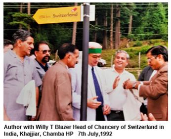
On July 7, 1992, I accompanied Willy T Blazer, vice counsellor and head of Chancery of Switzerland in India, who brought Khajjiar on the world tourism map by christening it as “Mini Switzerland”. He put a signboard of a yellow Swiss hiking footpath showing Khajjiar’s distance from the Swiss capital Berne — 6,194 km.
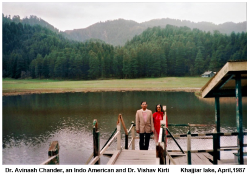
I wished I could; and I made it to Switzerland twice; in 1997 and subsequently in 2017. I have pleasant memories of Ice ‘Palace of Jungfraujoch’,from where I posted a picture post card back home to my wife, Bua Jee.
My second visit was to be with my son, Amb. Raja Aseem and my grand son Madhav, in Geneva. While I was preparing, yet; I received many calls & mails, proposing me to join them in ‘Hiking Alps’. I was delighted over the invite to be among three generations- going ‘mountaineering in Swiss Alps’. I sensed a great pleasure embedded with a warmth of kinship; & enthused, I happily said ‘Yes’. Having done a lot in Himachal, especially in Pangi Vally, Himalayas , where once I trekked a stretch of 25 KMs out of 150 in a day in one of the most difficult terrains in Distt.,Chamba.
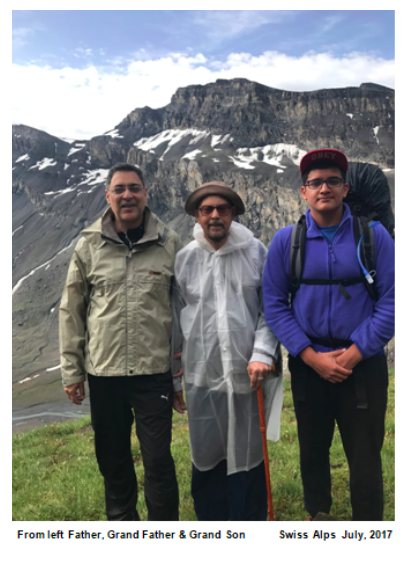
With ‘Go ahead, Hike Swiss Alps’ as the theme andRobert Prochazka of Austria as the team leader, we were supposed to commence our journey, in Just a day after my arrival in Geneva. It all, of course, depended on the weather forecast; we made the final decision 24 hours in advance, as we could cancel the rooms until the day before. However, ‘Weather bulletin’ of 7th forecast: ‘In foehn valleys gusts around 75km/h locally possible’.
- ITINERARY
- The meeting point was the Railway station in Kandersteg 9:30 sharp.
- WE had to leave Geneva in time to catch the bus to the Gondola at 9:44.
- By car: Geneva – Kandersteg it takes 2hours 40 minutes
- From Leukerbad to Kandersteg or vice versa with an overnight stay in Lämmerenhütte from Saturday 8 to Sunday 9 July.
- THE HIKES
The hike is around 7 hours plus 3 hours (detour to overnight place); up to 10 hours hiking in two days.
- The hike, 1. day:
- Kandersteg: 1174m Sunnbühel: 1934m Lämmerenhütte: 2502m
- From Sunbühel to Lämmererhütte it is 4 to 5 hours or around 700 m up and around 150 down.
- *That night, only Aseem, with a few more, hiked to and fro, perhaps, Gemini Pass. I and Madhav went to bed, early.
- The hike, 2. day:
- We could go to the Wildstrubel glacier, and back to Lämmerenhütte (1h30 both ways), from there to Gemmi Pass (1,5 hours) an then down to Leukerbad either on foot or by cable car. We might be in Leukerbad around 1 o clock. The spa in Leukerbad offers a ticket for 3 hours for 26 CHF.
- Robert had an idea:- climbing Wildsstrubl Mountain (3.250) Sunday morning, but you need a guide for that, this is a really alpin tour.
- *We skipped all that and came straight down to Leukerbad where we had good lunch and a round of the town.
- THE HUT
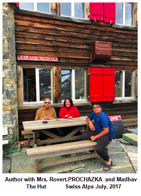
- We had 18 beds for us; males slept in one with 10 beds; and ladies and children adjusted in the one with 12 bedded room. We had not opted for special rooms.
- Robert cited a sentence from the homepage: “The use of a mountain hut sleeping bag is not obligatory!!!”
- The price for overnight stay plus dinner and breakfast was around 80 CHF
- FOOD: Saturday evening they served pork and a veggie dish.
Madhav trekked much faster, even carrying an added baggage of his Dada jee and was at the Hut , at least, an hour before we could make it. Aseem and I were trailing behind in the incessant rain, thanks, being considerate, he pulled out a rain coat for me . Despite sparse sign boards, we lost the track, at least, once. Robert’s ‘How to get lost in the Swiss mountains’ kept echoing in my mind.
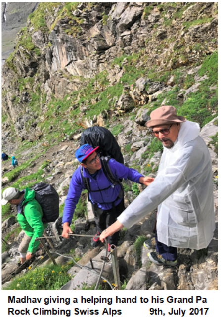
Last stretch was the ‘Rock climbing’ and that was scaring and risky; looking back -instills confidence in me.
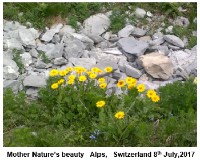
For those for whom simply hiking in the mountains is not enough, there are trails to Switzerland’s high Alpine glaciers. Above the tree line is the area defined as “alpine” where in the meadows, plants are found that have adapted well to harsh conditions of cold temperatures, aridity, and high altitudes. On the high rocky ledges the spring flowers bloom in the summer. Perhaps the best known of the alpine plants is Edelweiss which grows in rocky areas. The plants that grow at the high altitudes have adapted to conditions by specialization such as growing in rock screes that give protection from winds (depicted in this write- up in the title photo ‘Mother Nature’s beauty’)
For our own safety, it is advisable to take a guided hiking tour, In spite of the fact that the hiking trails are signposted, one shouldn’t venture unprepared into the Swiss mountains. Preparation should certainly include planning (weather, route, level of difficulty), checks and assessment of one’s own fitness on the day, as well as the right equipment.
- Must-haves:-water bottle, provisions, protection from the sun and rain, headgear, empty bag for rubbish, blister plasters, wet wipes/tissues. If you wish to sleep well in a ‘shelter hut’ after the day’s tiredness, do not forget ear buds to guard against the snorting and grunting sounds in breathing of the team mates while they are asleep. Better to carry a map with the hiking route (one can do without internet)
Prof. (Er.) Chander P Mahajan is an art critic & a free lance journalist. The Environmentalist stays in Shimla and Dalhousie, Himachal Pradesh, India.

